
It is quite common to decomposite the terrain situation into simple entities for better undestanding – a process called an archaeological terrain documentation. However only few people understand this attitude properly in sense of consequent synthesis of documented sources. In the case of later graphics/presentation we could easily speak about reverse modeling. In the following section we would present the abilities of 3D modeling for “bringing the life of ordinary documented stratigraphic features”.
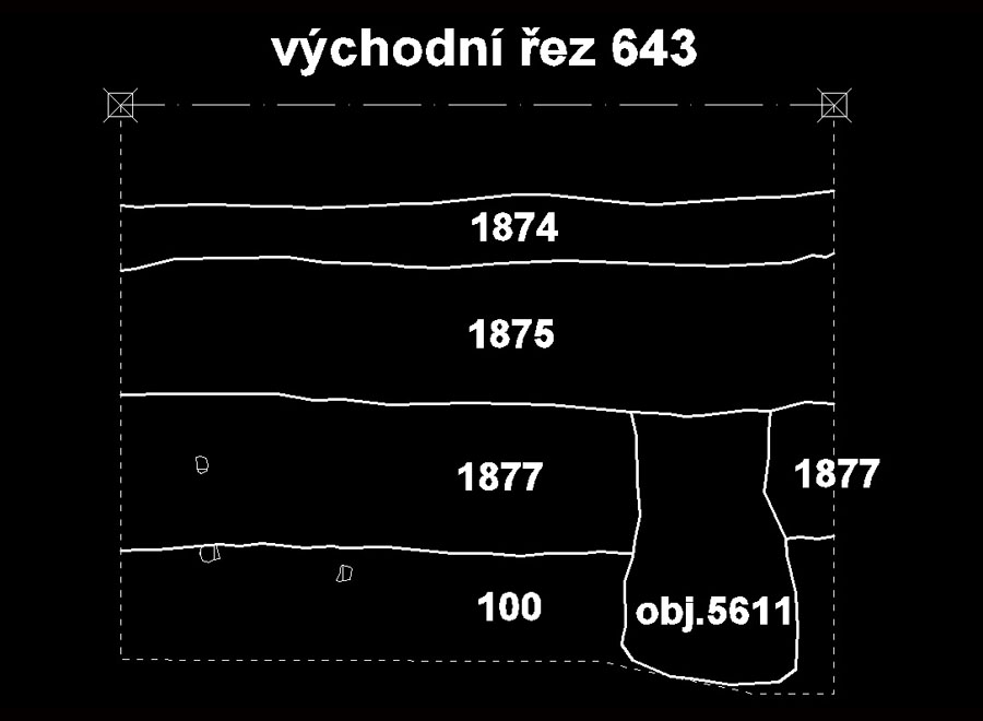
Following pictures represent the source (quite simple) documentation of typical rectangular trench.


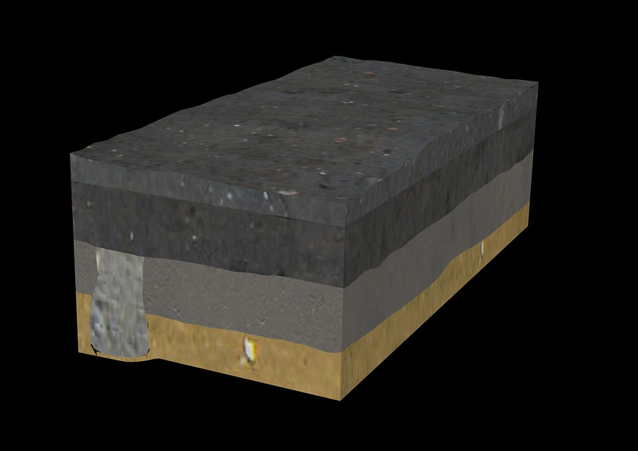
Digitizing these “paper sheets” in the CAD environment we could easily get the following picture. Please notice that we model the situation according Sir Harris principle “definition of stratigraphic feature is a definition of its surface”.


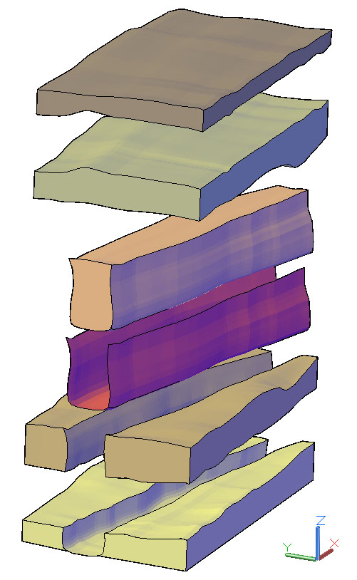
Final model would be easily decomposited into its basic stratigraphic parts. The cut element (“negative feature” is coloured red and obviously has no volume.) Lets call it “stratigraphy for dummies” :) that shows the basic principles of simple stratigraphy superposition.
(Pictures are taken from archeoconsult.org site)