
Almost ten year passed since I’ve been on Monkodonja castellieri.
Nothing has changed – except those tourist information tables and the beer prices in Rovinj vicinity. The expedition of me, Alsu, Max and Šaňo via Istria trip also visited the famous Iron Age hillfort at Monkodonja (it: Moncodogno; lat: Cydonia oblonga). Well, famous from my point of view because of my engagement on Ljubljana University years ago – slovenian department of archaeology led the excavation seasons from 1997 till 2007 here (OK, some Germans and Croatians along :)). The famous work of Carlo Marchesetti (I castellieri preistorici di Trieste e della regione Giulia, 1903) did not mentioned this hillfort (but did 300 others) and I recommend to read this paper for those of You interested in Istria castellieri culture.
After a rich lunch somewhere around Rovinj we took a trip to hillfort. The youngest member ignored the sacred archaeological site completely and prefered a short sleep before more interesting things – playing with the stones on the sea shore. Maybe was he right.
-
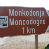
- 1 km by feet.
-

- Lunch before moving to hills and bushes.
-

- The youngest expedition member.
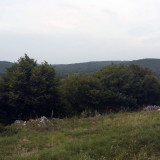
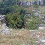
The fortress itself is situated on a not very distinct hill of elliptical shape. Someone could be surprised of a small dimension and the vertical insignificance in comparison to a) the expectation of “big fortress Monkodonja” and b) adjacent hills. Really, the hills around Monkodonja give the impression of “being among equals”. The viewshewd analysis provides the same result – the choice to start a settlement here was not influenced by its extraordinary altitude.
-
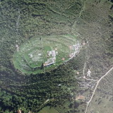
- Vertical aerial view to the Monkodonja hillfort with the main components description.
-
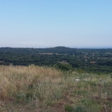
- Viewing to the south from the hillford top.
-
- Viewing to the north from the hillford top.
-
- Viewing to the west from the hillford top.
-
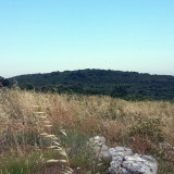
- Viewing to the north from the hillford top.
-
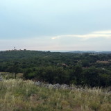
- Viewing to the north from the hillford top.
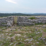
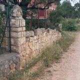
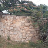
Present stone structures are the result of the previous archaeological excavation and consequent reconstruction (what about walls height? Derived from what?). A short fotoreport reveals the technical details of dry stone walls (is this the technique of “core walls” – carrying shell of big stones and small stones filling?) and somewhat spectacular entrance system of the gates.
There are rumours around the techniques of excavation to be “non stratigraphic” and “Pompei premised”. Having no idea about this I would only state that thematical interpretative results (see phase plan) seem to be of very high professional level. Contrary, the term “cult cave” used for the hole in the carstic subsoil seems to be nothing more than lack of fantasy and pragmatic attitude. What about “refrigerator” in pre-freons times?
-
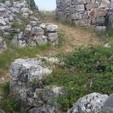
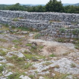
- A northern, partly reconstructed gate.
-
- The wall near the northern gate – a view to the west.
-
- A western gate entrance system.
-
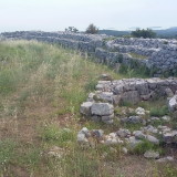
- A view from the northern part of the wall circle eastwards.
-
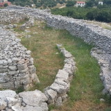
- Revealed and partly reconstructed structure of the inner settlement dwelling.
-
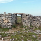
- The reconstructed western entrance to the acropolis.
-
- The dry stone wall construction details.
-
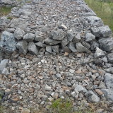
- The dry stone wall construction detail.
-
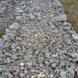
- The dry stone wall construction detail.
-
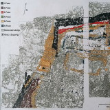
- The ground plan and its interpretative phasing. The acropolis.
-
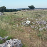
- The entrance of the “cult cave”.
-
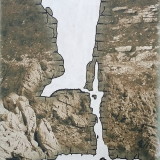
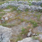
- The “cult cave” section.
Monkodonja today is calm and dead place with exception of ants and the snakes (notice the clay color – this country is also called “red Istria”) in contrast to Kokuletovica downhills. There are a lot of new houses there – maybe built of stones of the former Iron Age stronghold?
-
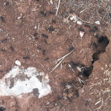
- Ants colony on the hillfort.
-
- The origin of these new stone walls? Reutility, reusability?
-
- Kokaletovica village – a “new” stone walls.