
Being on Caucasus a year ago I decided to make a collection of historical maps of this region. The first one I found somewhere deep in my NAS is map of the Caucasus from 1800 – 1813.
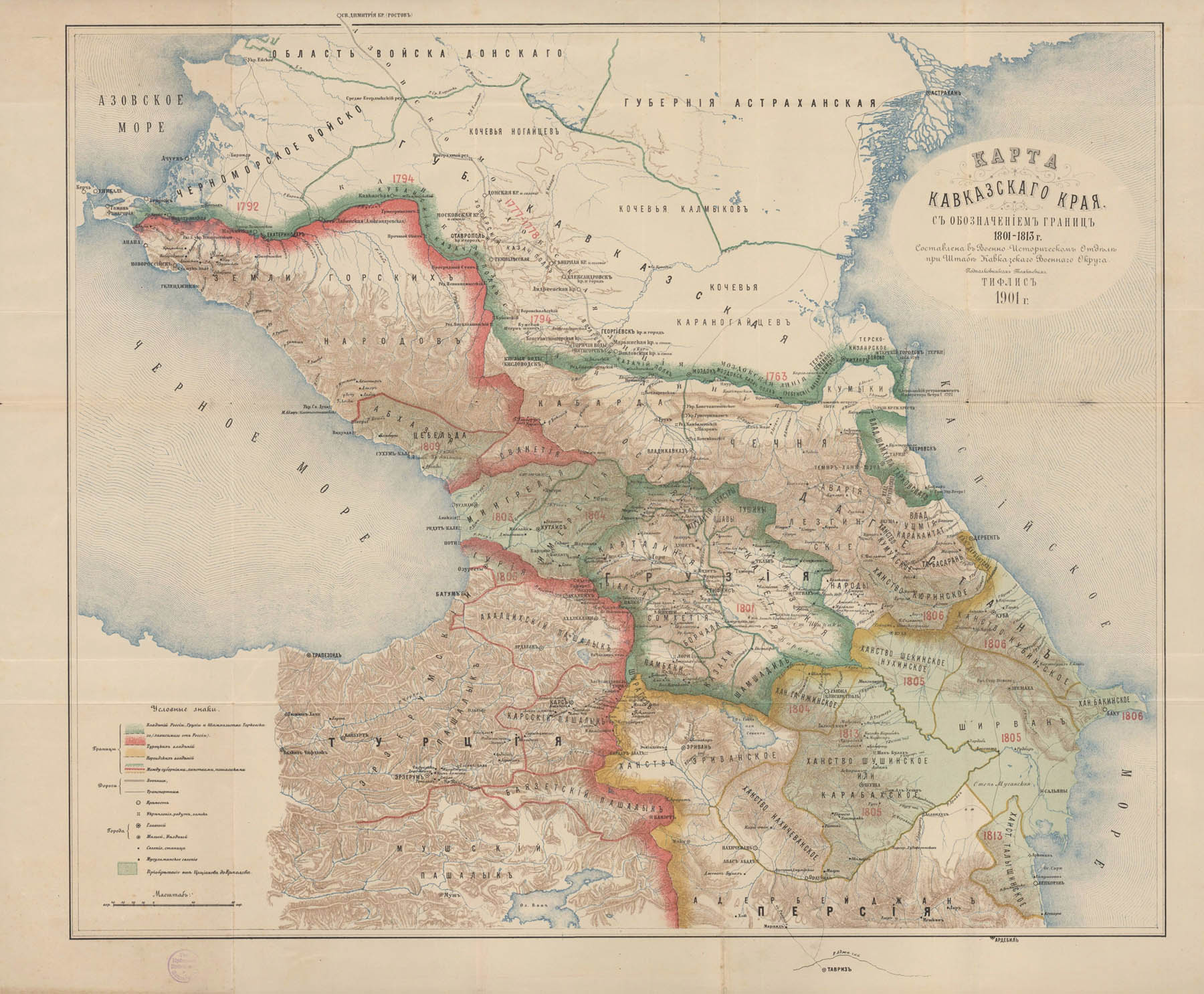
To be honest the map was created and published 1901 so it presents the backward engineering and projection of the situation 100 years ago. One cold only assume the accuracy. Nevertheless the regions themselves are roughly the same as today – a nice example of steadiness and tradition in this “still on the move” region.